Venus
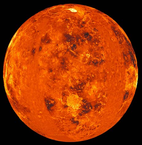
This global view of the surface of Venus is centered at 0 degrees east longitude. Magellan synthetic aperture radar mosaics from the first cycle of Magellan mapping are mapped onto a computer- simulated globe to create this image. Data gaps are filled with Pioneer-Venus Orbiter data, or a constant mid-range value. Simulated color is used to enhance small-scale structure. The simulated hues are based on color images recorded by the Soviet Venera 13 and 14 spacecraft. The image was produced by the Solar System Visualization project and the Magellan Science team at the JPL Multimission Image Processing Laboratory, and was released on October 29, 1991.
Venus Concepts
Solar System Concepts
Solar System Exploration
| HyperPhysics********** Astrophysics | R Nave |